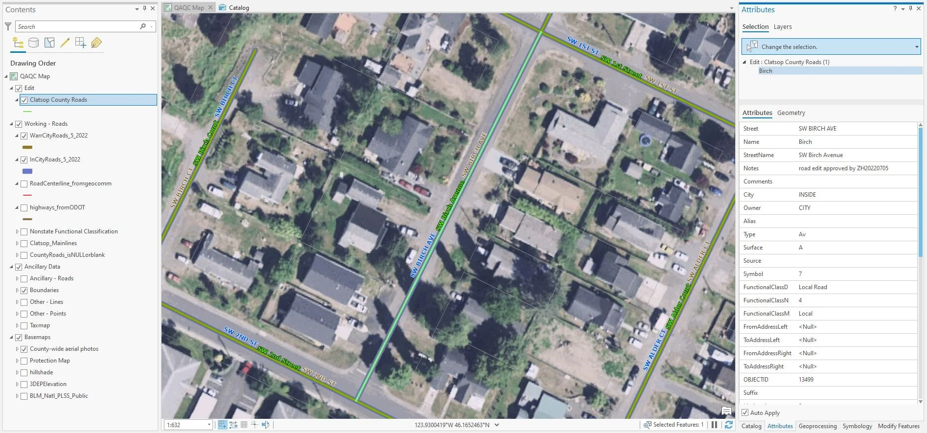
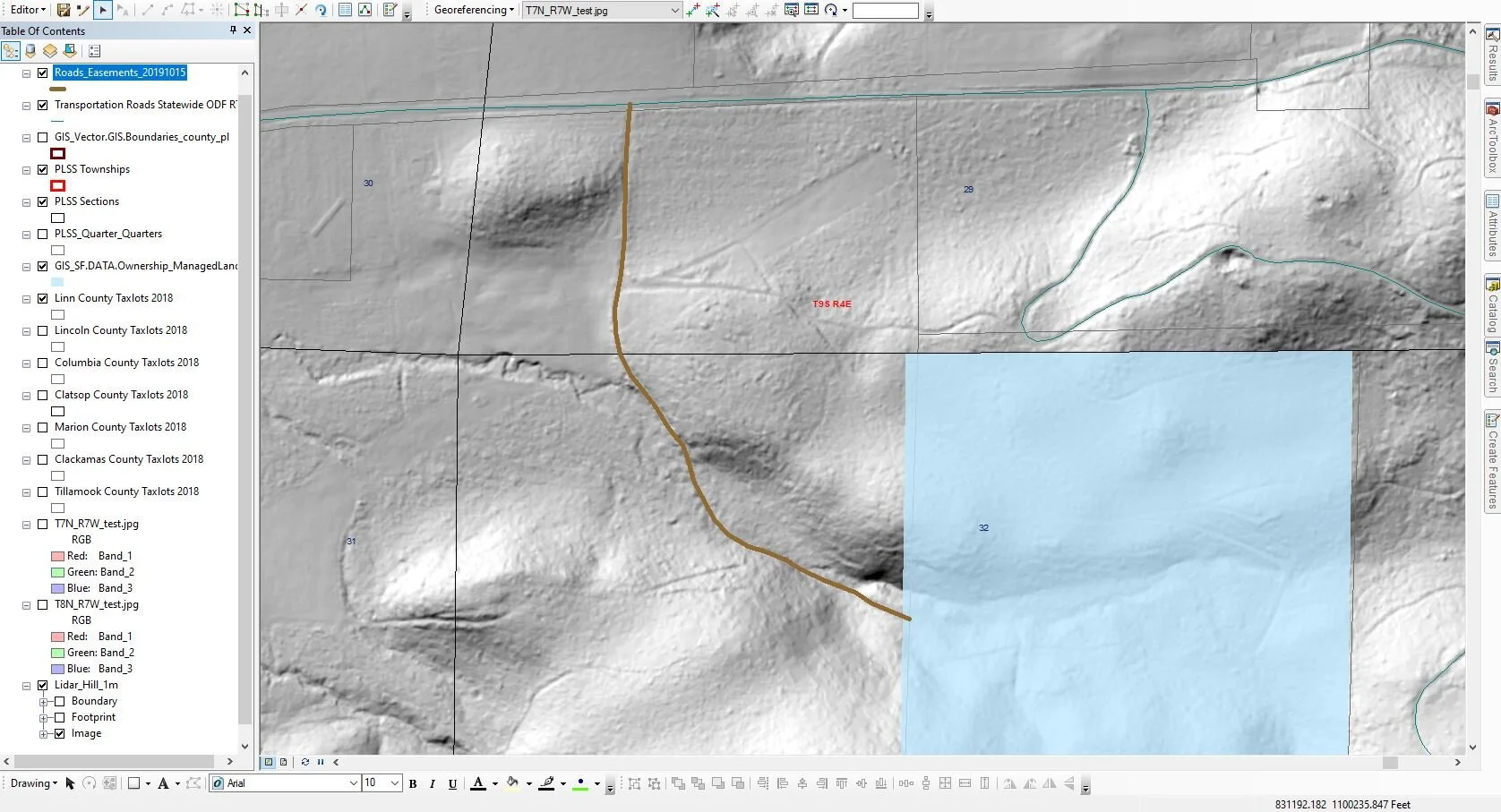
This is a screenshot of my typical ArcGIS Pro workspace. I have standardized the structure of my ArcGIS Pro project files (.aprx) to ensure consistency between all of my workspaces. Standardizing operating procedures wherever possible ensures efficiency in project execution and accuracy in final deliverables.
The purpose of this specific project was a QA/QC of Clatsop County’s “roads” sde line feature class. This project requires that I work within a traditional branch enterprise database environment, where I am responsible to check out a versioned geodatabase, edit an enterprise feature class, save the edits and then reconcile and post the edits from my checked out database to the parent database. This project shows my strength in working comfortably and efficiently within an enterprise database.

Upon identifying an opportunity for growth within the GIS Division at Clatsop County, I pitched an idea to my supervisor to begin creating GIS Reference Documents.
This is a simple reference document showing a GIS user how to, step-by-step, create a new GIS project directory and ArcGIS Pro project file within a versioned SDE environment.
These documents not only benefit our department by implementing standard operating procedures (the first SOP within the GIS Division) but they also ensure that every new GIS user within our organization is set up for success. I am very proud of this small project as it exemplifies my passion for organization, strategic planning skills and collaborative spirit.
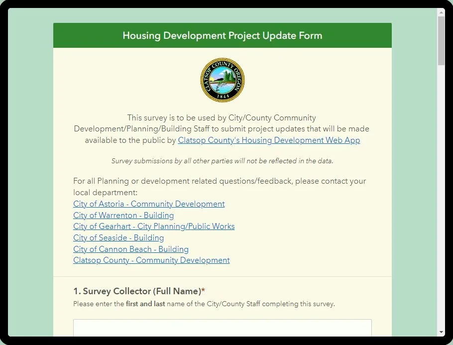
The stated goal of this project is to inform the public as to what housing developments are currently under way in their community. To complete this goal, a task force was created and I was assigned as the data lead. The first task was to compile over 5 years of data from many sources and standardize the data format. I also requested a meeting with local city planners so I could speak directly to them and gain valuable input. I then took that feedback and designed, created, published, and deployed this survey. I then analyzed the data and compiled monthly reports to leadership. This survey also feeds directly into the public-facing Clatsop Housing Development Web App. This project was an excellent opportunity for me to lead from the back and expand my knowledge in the crucially important GIS workflow of enterprise data collection and analysis.

The Clatsop County Planning Dept. routinely requires maps for land use reporting. This map is an example of a final graphic used in a Planners’ final report. It displays taxlots overlaid on top of an aerial photograph, with a square buffer.
These kinds of simple graphics with tight turnarounds (<1 day) are common tasks assigned to me in my capacity as the GIS Technician in our office.
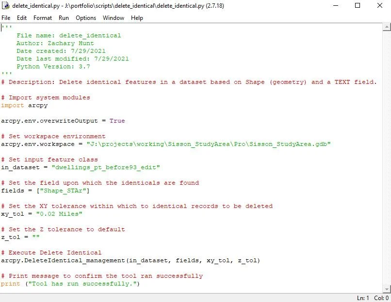
This python script was written to delete identical features in a dataset base on Shape (geometry) and a text field.
This script is an example of identifying when a geoprocessing task may be repeated, and automating that task for future. A core skill that I have is the ability to think outside the box and make tasks easier on myself, which in turn increases my productivity and efficiency as a GIS Technician in a team setting.
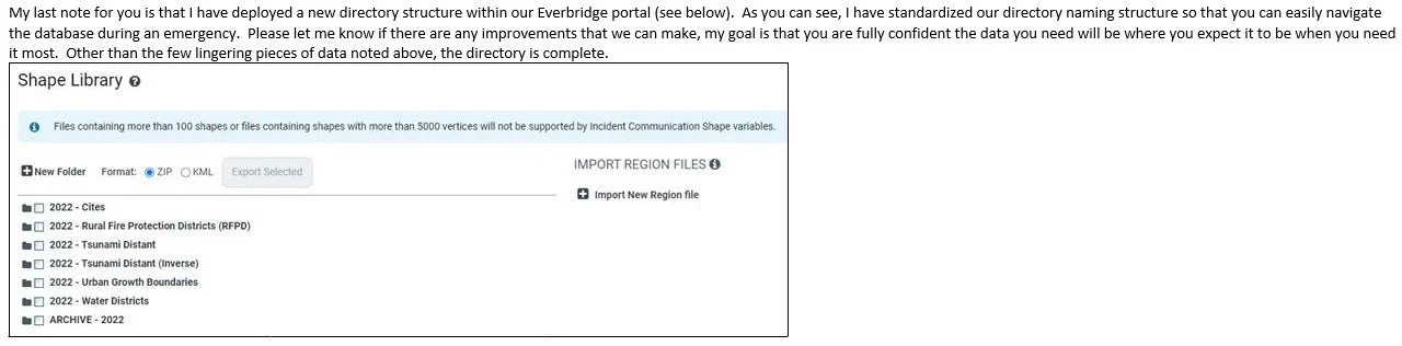
I serve as the spatial data steward for the Clatsop County Emergency Management Department. This role has also given me the unique opportunity to serve in a supportive role on a diverse team of high-level decision makers. I’ve learned how to guide decision-making in the role of a data steward, which often requires effective communication skills in which I must effectively articulate my technical knowledge in a way that serves leadership’s decision-making process.
To complete this assignment, I acquired and processed the necessary data to meet necessary data standards. I then worked closely with technical experts to ensure data accuracy and integrity; organizing the data structure and standardizing the directory for ease of use during an emergency. Lastly, I met with emergency managers to provide a debrief and offer maintenance services.
An example of my experience managing a long-term project to meet multiple needs for a stakeholder. This entailed taking a historic, tabular dataset (legal descriptions) and creating a feature class for which Land Specialists will use to aid in their daily workflows laying out timber sales. This project took many months to complete, which meant that I needed to be a self-motivated, solutions based GIS professional to accomplish the given deliverables by the end of the contracted time.
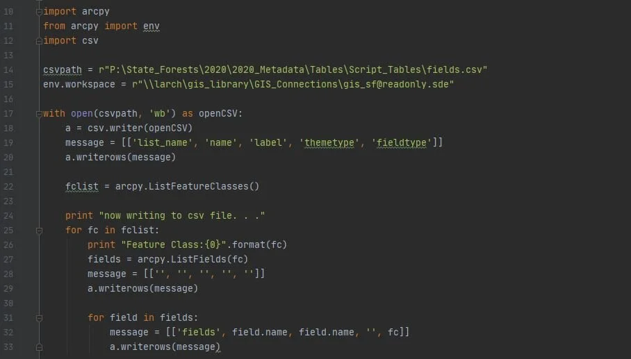
Another example of my professional experience of creating solutions to complex real-world geospatial problems by designing, building, deploying, analyzing and reporting results within the ESRI ecosystem. This project specifically addresses an enterprise need for an update to all network metadata, which I solved using Python, ArcPro and Survey123 Connect for ArcGIS. This script extracts data from a network database and formats that data into a .csv file to be easily migrated to Survey123 Connect.
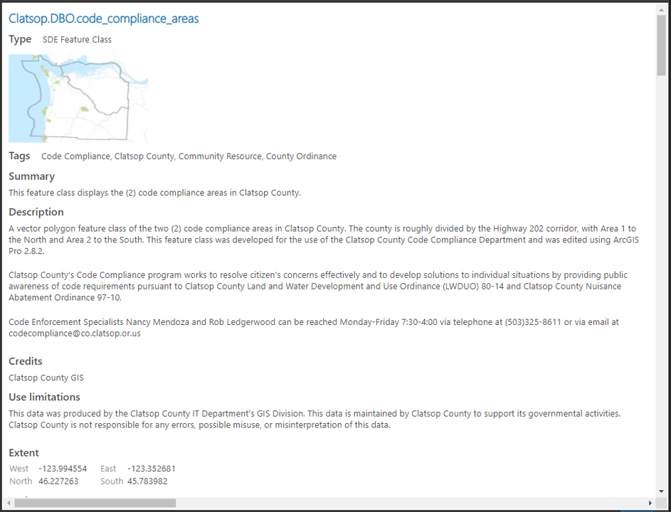
Designed, standardized, created, edited, attributed and published corrected SDE Feature Class metadata.
This is an example of how I have contributed to the back end standardization and clean-up of many datasets used by Clatsop County Staff as well as Public Stakeholders.
I am always looking for ways to improve and standardize data that I use, and this is an excellent example of me doing proactively. My attention to detail has been noted by the county as having sparked important conversations between the GIS Department and the County Manager’s Office regarding policies and expectations of GIS projects.
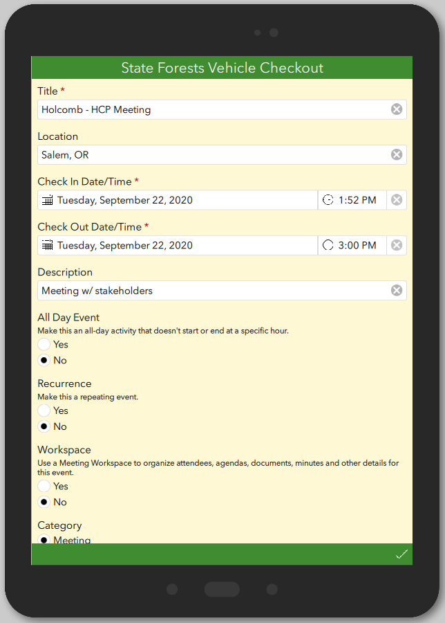
This survey is an example of my proactive style of project management. After attending a division wide meeting at my place of employment, I noticed a unit that I don’t collaborate with was using a static excel table to check out vehicles for off-site meetings.
During the following weekend, I designed this survey in Survey123 Connect, which employees were able to download on their phone and feed the survey into a dashboard they can leverage before checking out a vehicle. This allowed employees to see in “real-time” which vehicles are available to them within their division.
I am always looking for ways to improve workflows through leveraging web mapping solutions. While cartography is a personal passion, web technologies provide fascinating and novel solutions to geospatial problems.
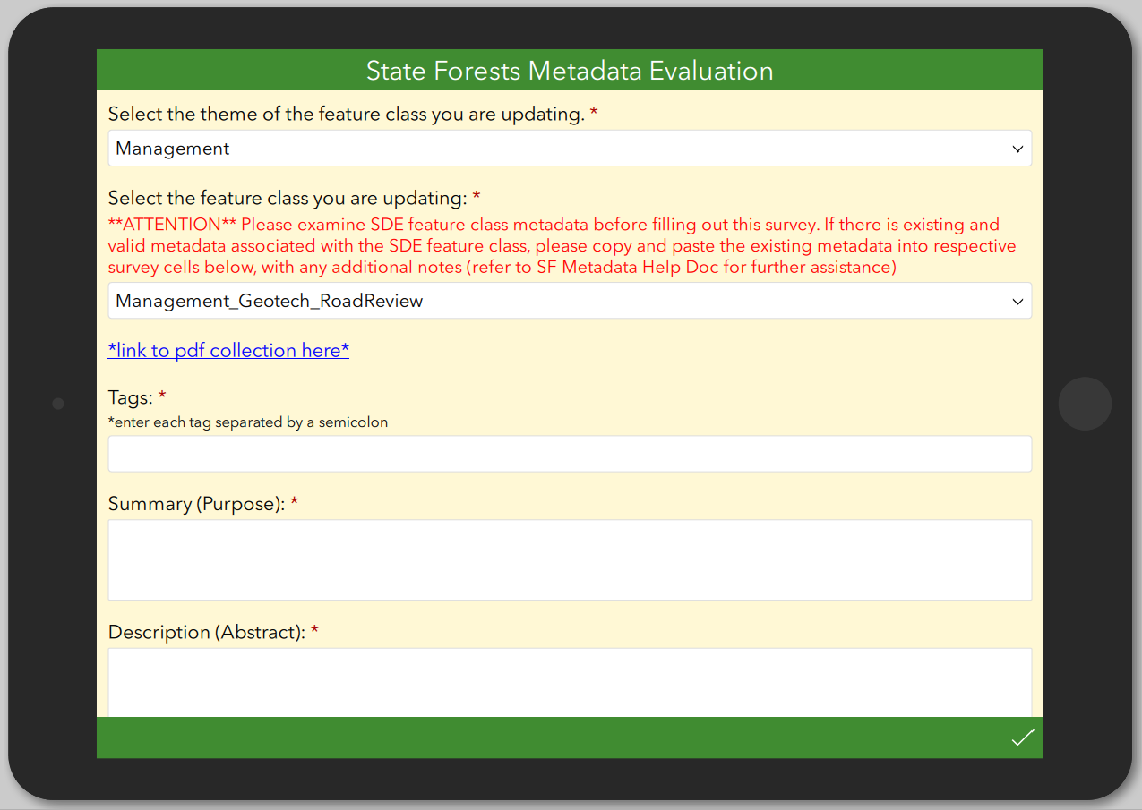
An example of my professional experience of finding solutions to complex geospatial problems by designing, building, deploying, analyzing and reporting results within the ESRI ecosystem. This project specifically addresses an enterprise need for an update to all network metadata, which I solved leveraging Python, ArcPro and Survey123 Connect for ArcGIS.
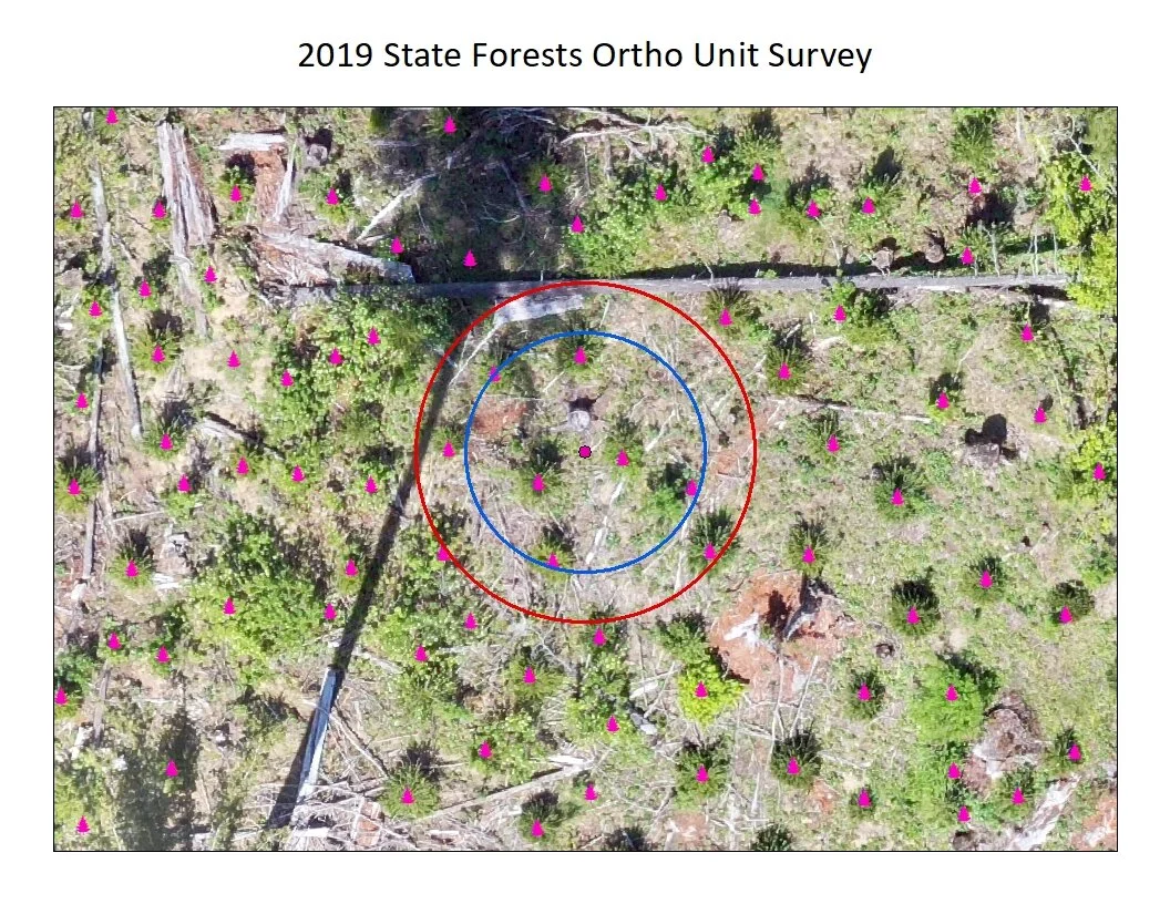
Orthoimagery Analysis for the Reforestation Unit at the Oregon Department of Forestry. An excellent example of my experience with imagery analysis in a professional setting and documenting my findings in reports provided to stakeholders.
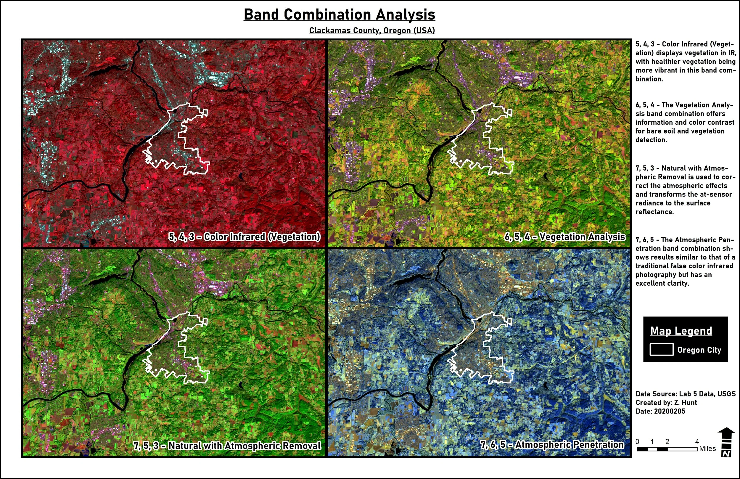
An example of my experience analyzing remotely sensed imagery. Manipulating the raster band combinations reveals differing common trends, which allows for analysis such as vegetation analysis or atmospheric penetration of uv rays in the atmosphere.
Orthoimagery Analysis for the Reforestation Unit at the Oregon Department of Forestry. An excellent example of my experience with imagery analysis in a professional setting and documenting my findings in reports provided to stakeholders.
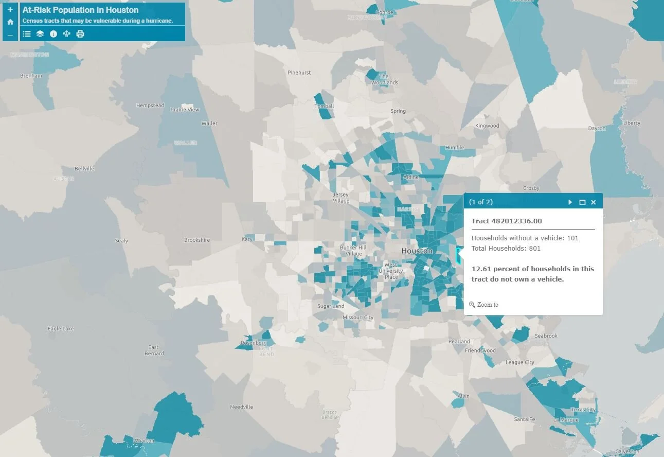
This is an example of my experience performing complex analysis within the ArcGIS Online environment and reporting my results in an easy-to-digest format. To view this interactive Web Application, please click here.