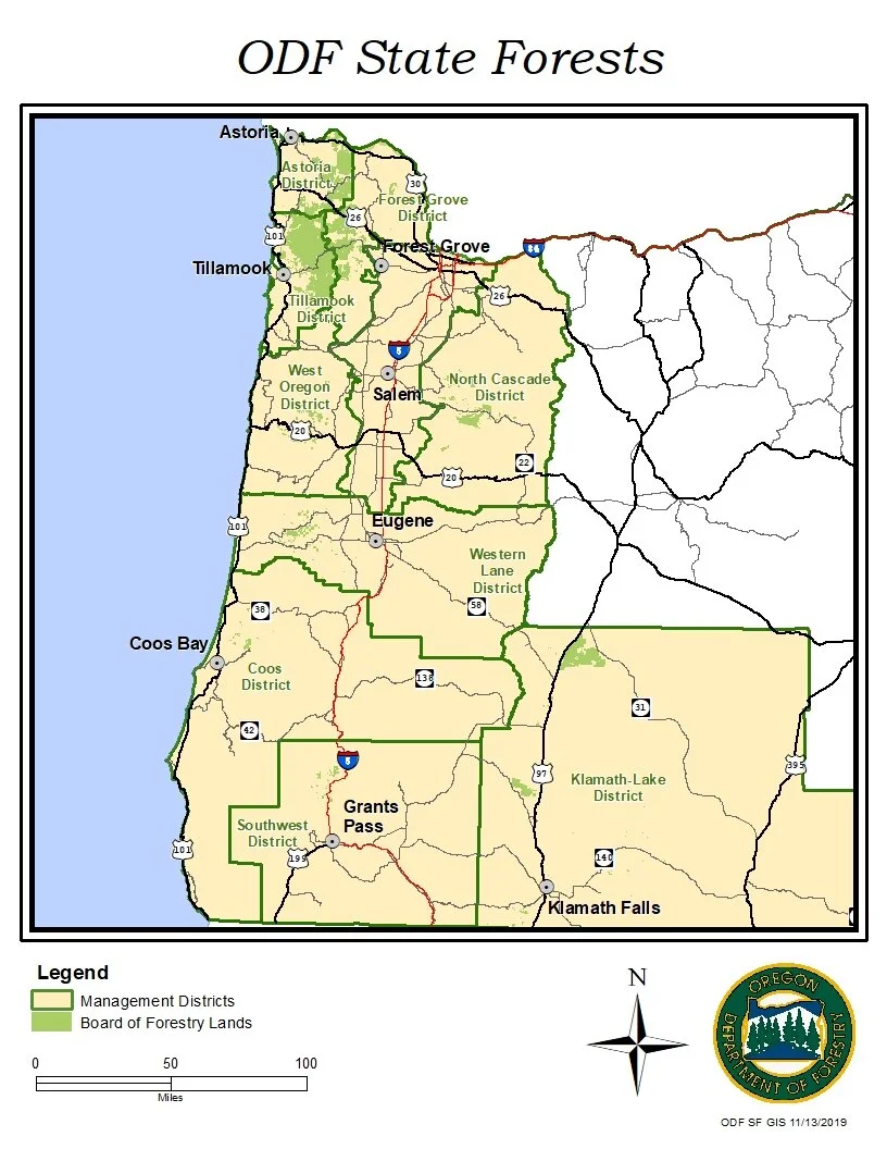
ODF State Forests Map - Published in the ODF Forest Management Plan
This map is part of a series that was published in the Oregon Department of Forestry 100-year Forest Management Plan. This is an excellent example of my experience collaborating with multiple stakeholders to achieve a final cartographic product worthy of public consumption.
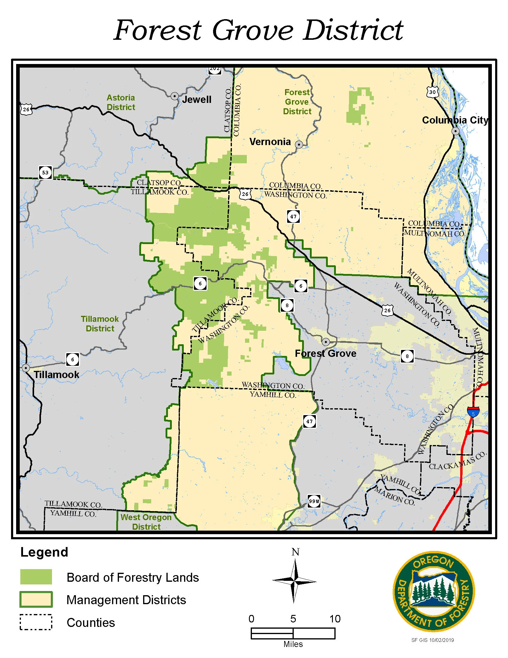
ODF Forest Grove District - Published in the ODF Forest Management Plan
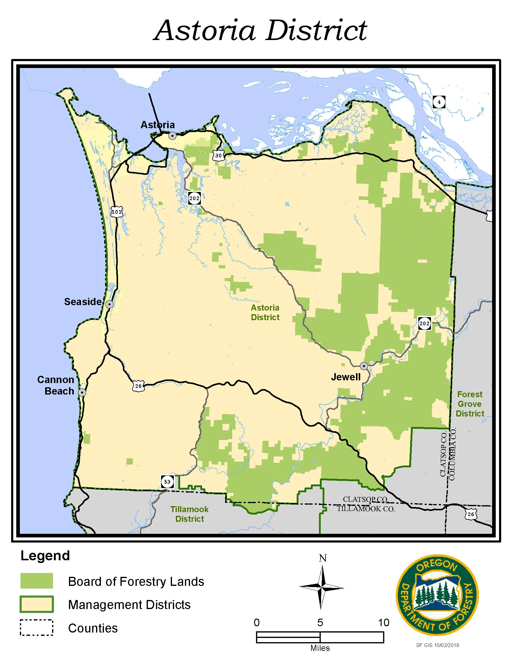
ODF Astoria District - Published in the ODF Forest Management Plan

ODF Tillamook District - Published in the ODF Forest Management Plan
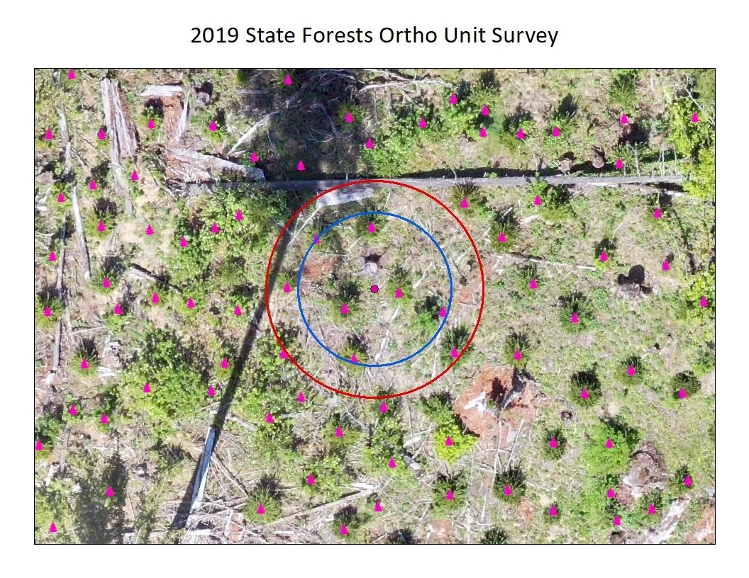
Reforestation Unit Analysis in the Clatsop State Forest
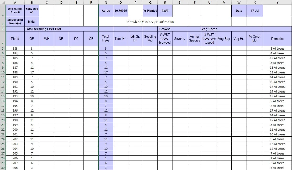
Reforestation Unit Analysis in the Clatsop State Forest
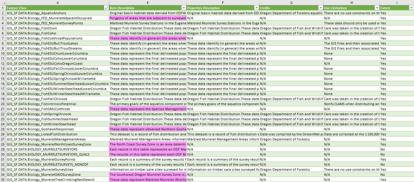
State Forests Feature Class Evaluation - Enterprise Metadata Quality Assurance
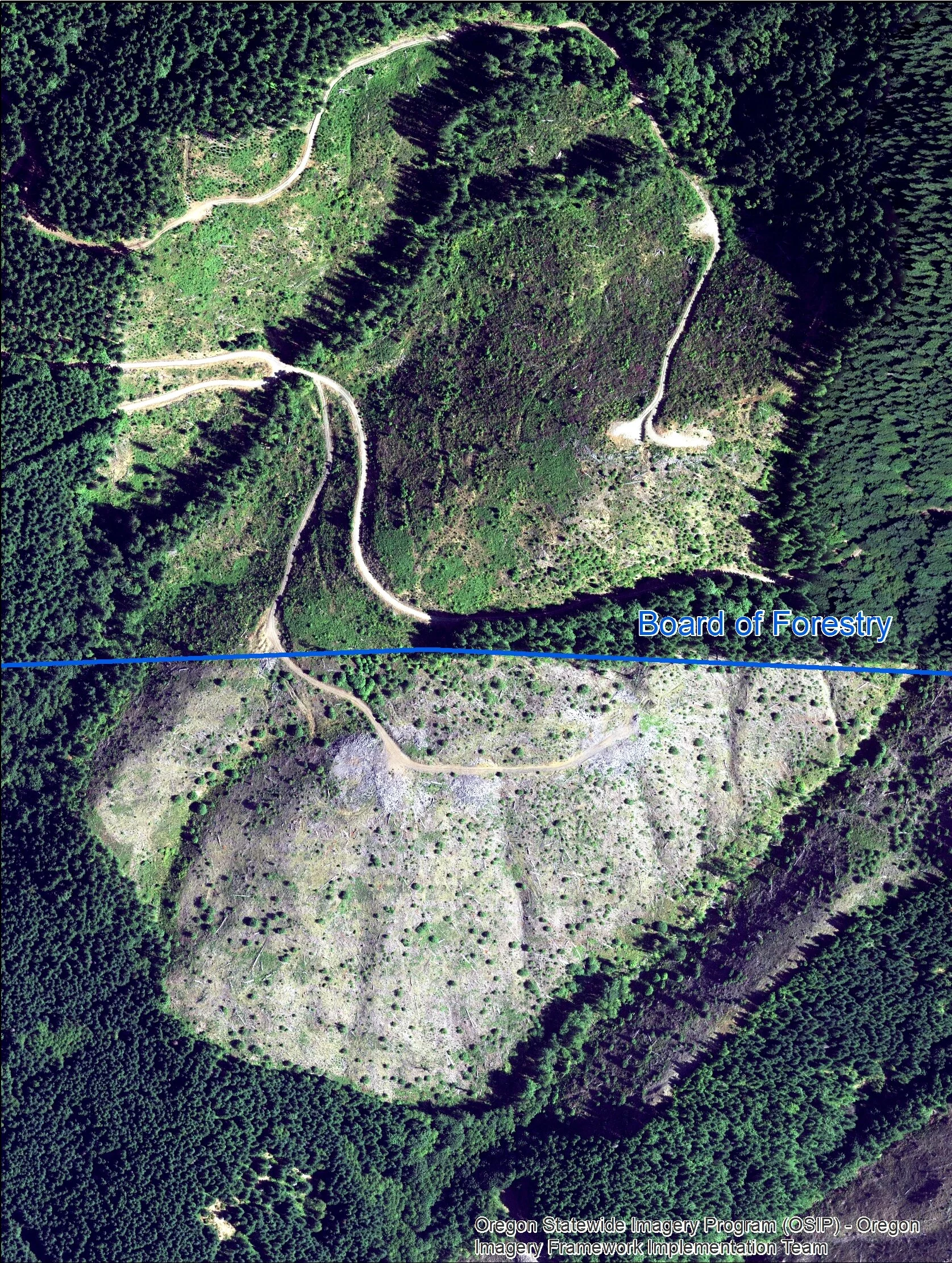
Clearcut Comparison Analysis
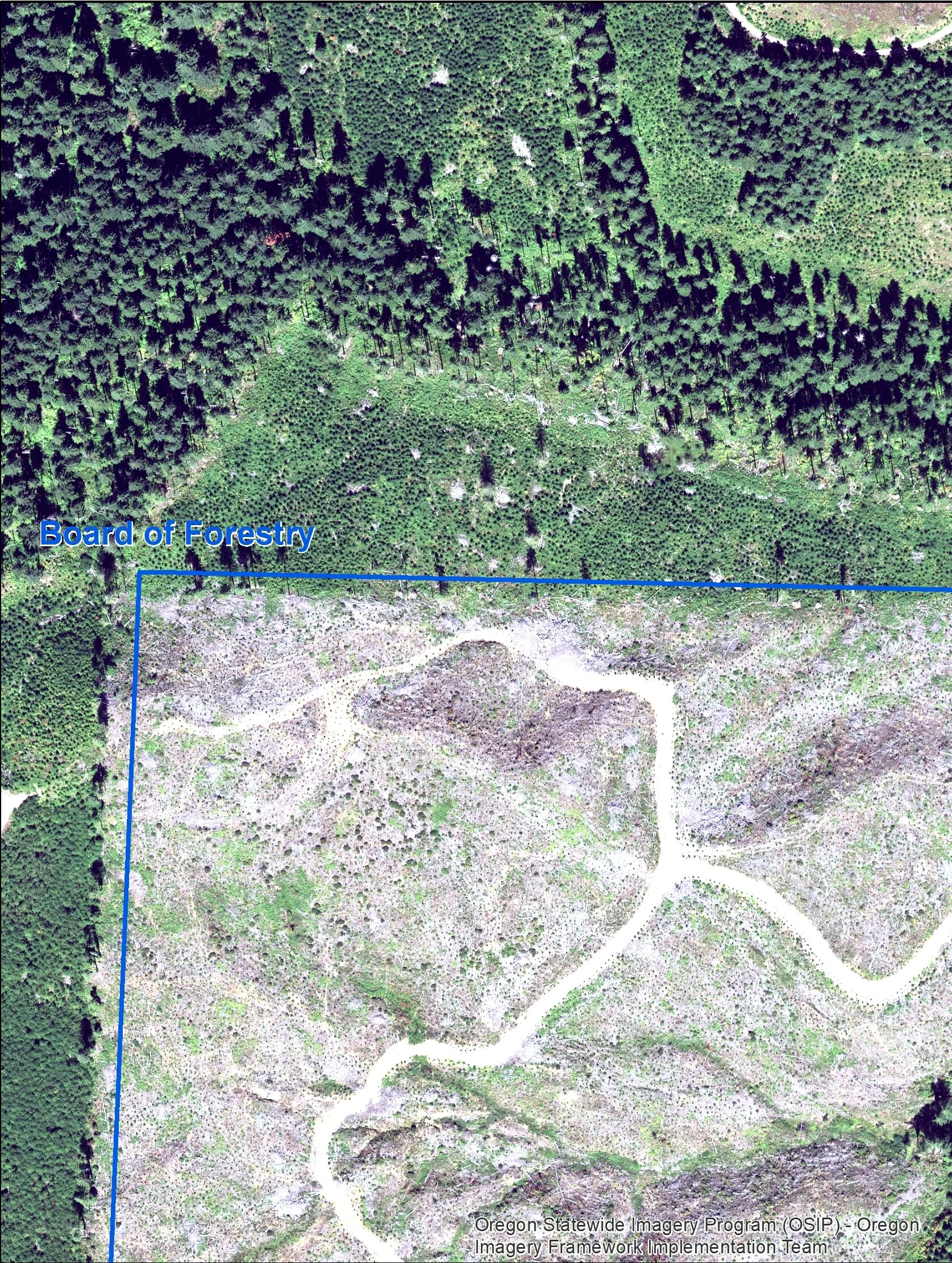
Clearcut Comparison Analysis
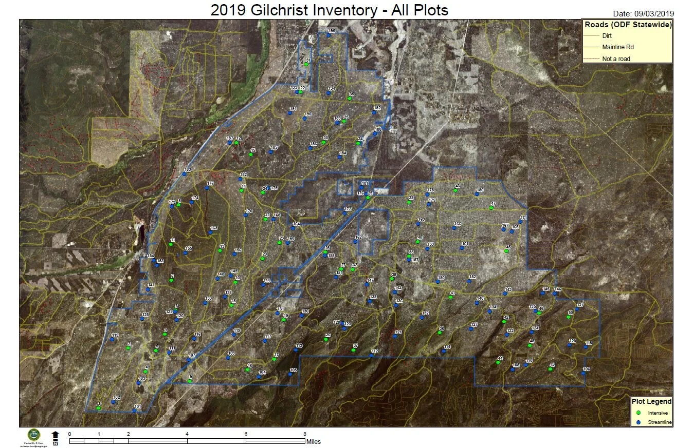
Gilchrist State Forest Inventory Project - Ortho Vicinity Map
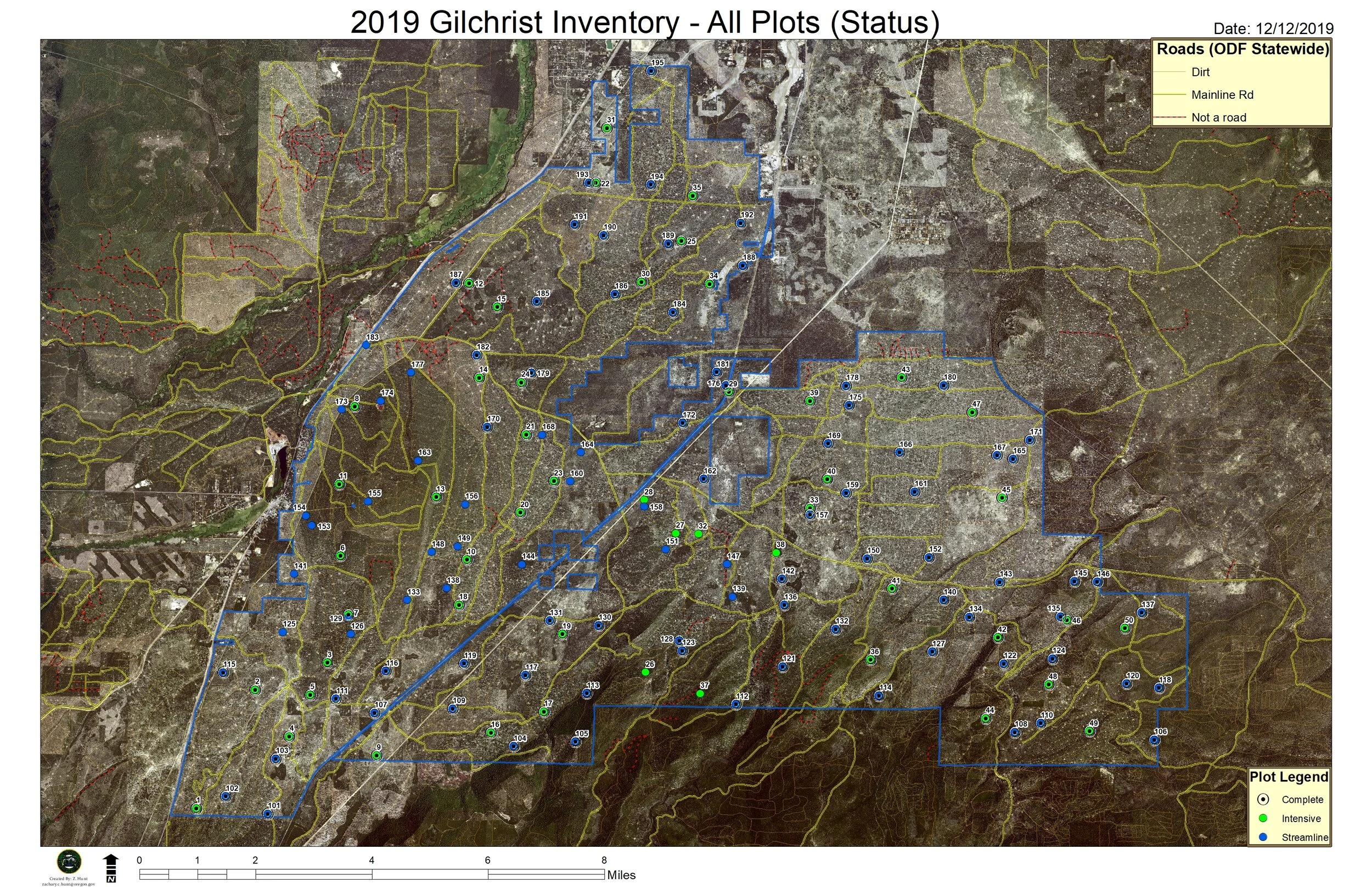
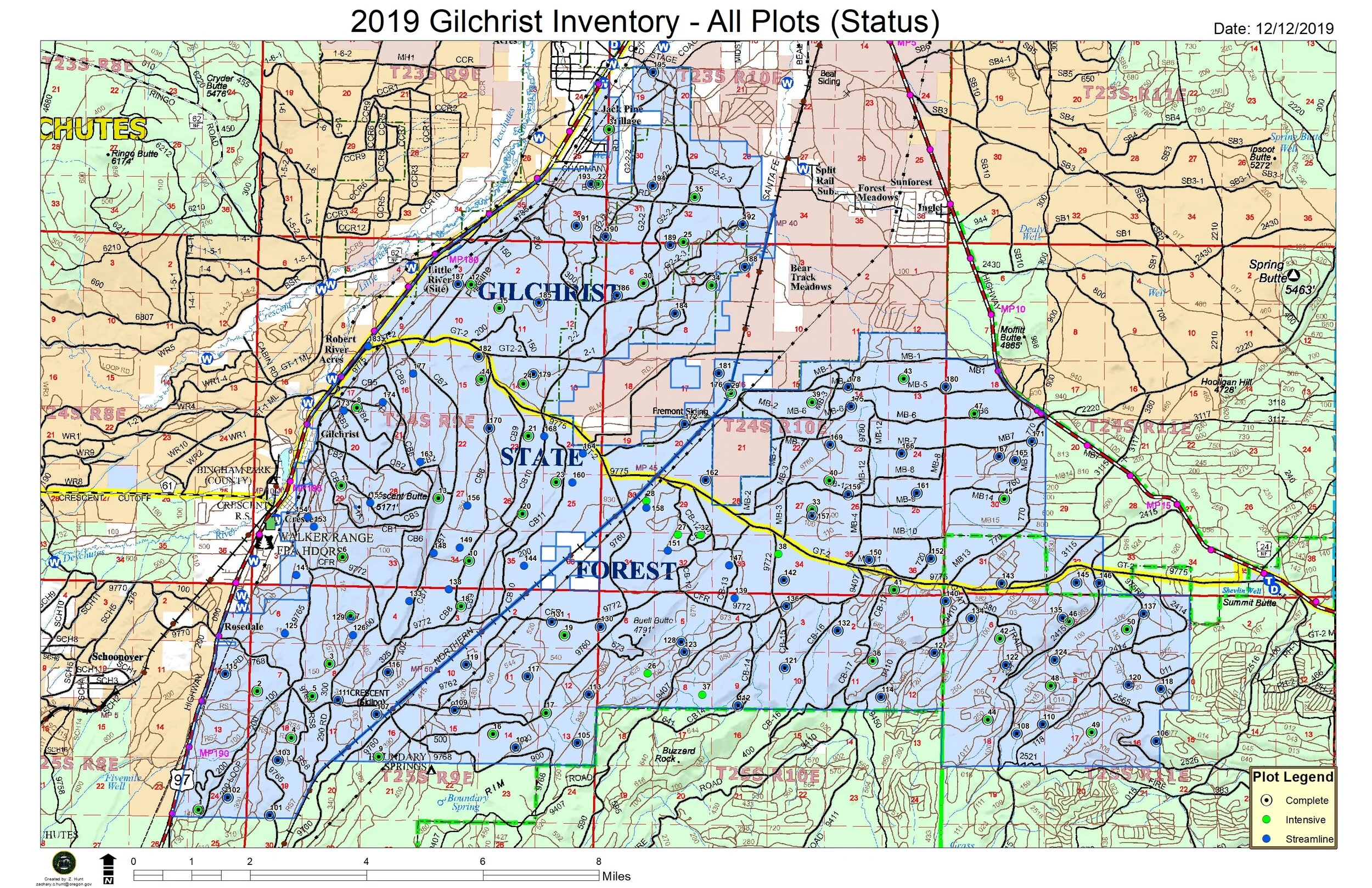
Gilchrist State Forest Inventory Project - Ortho Vicinity Status Map
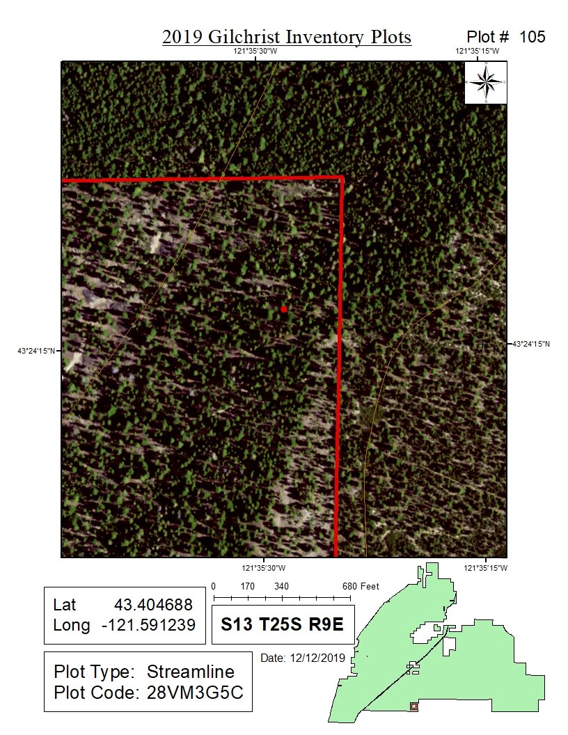
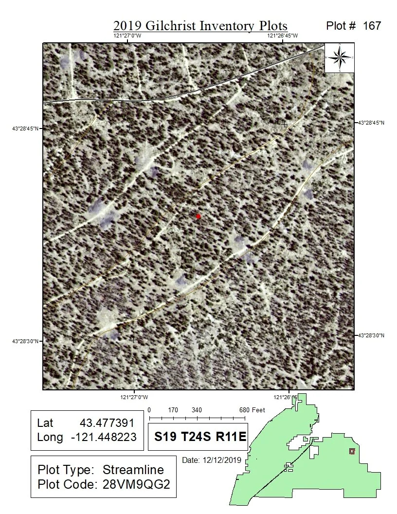
Gilchrist State Forest Inventory Project - Plot Map
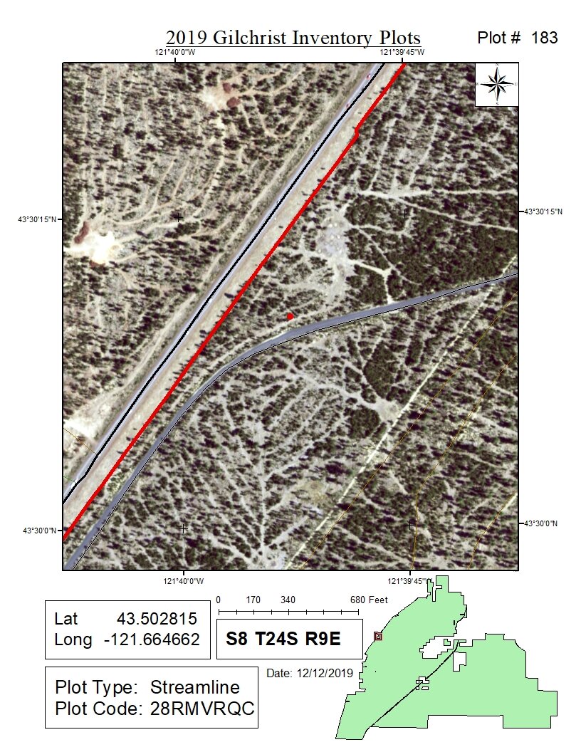
Gilchrist State Forest Inventory Project - Plot Map
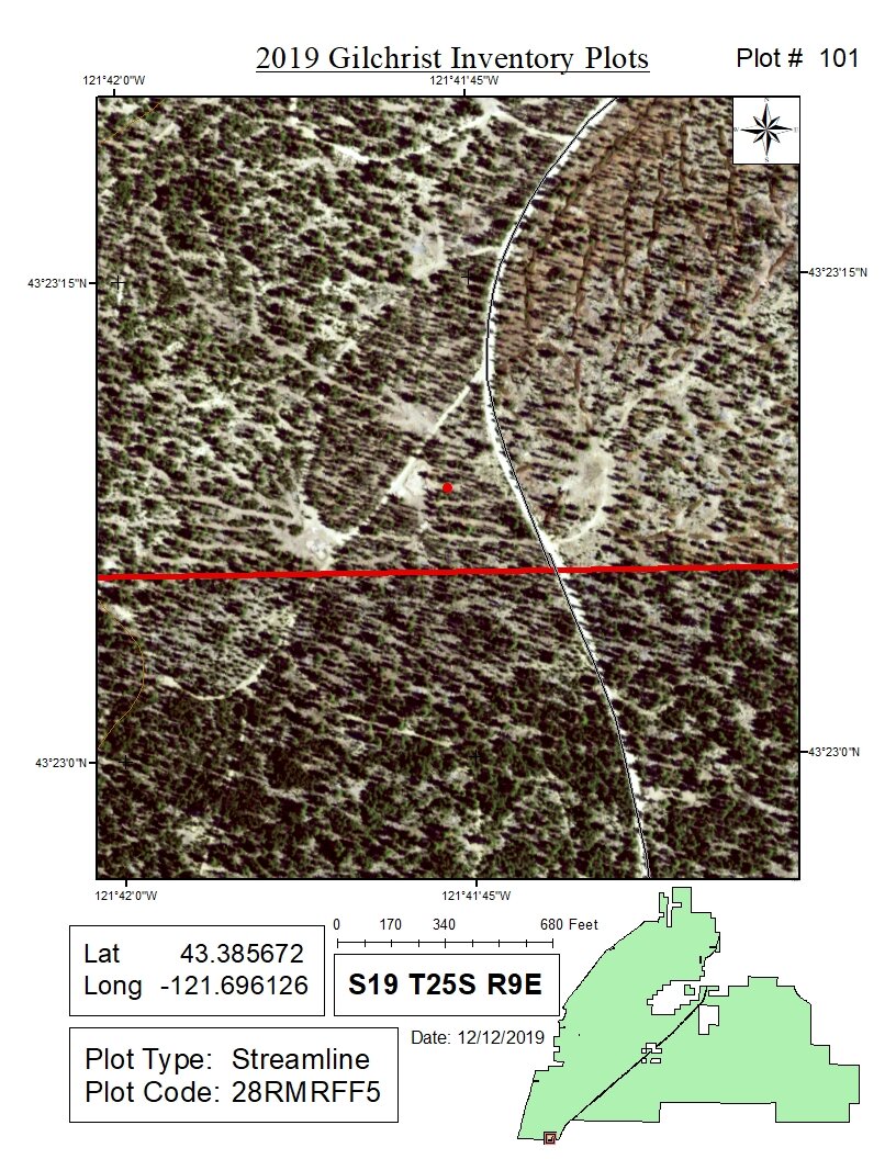
Gilchrist State Forest Inventory Project - Plot Map
Gilchrist State Forest Inventory Project - Vector Vicinity Status Map
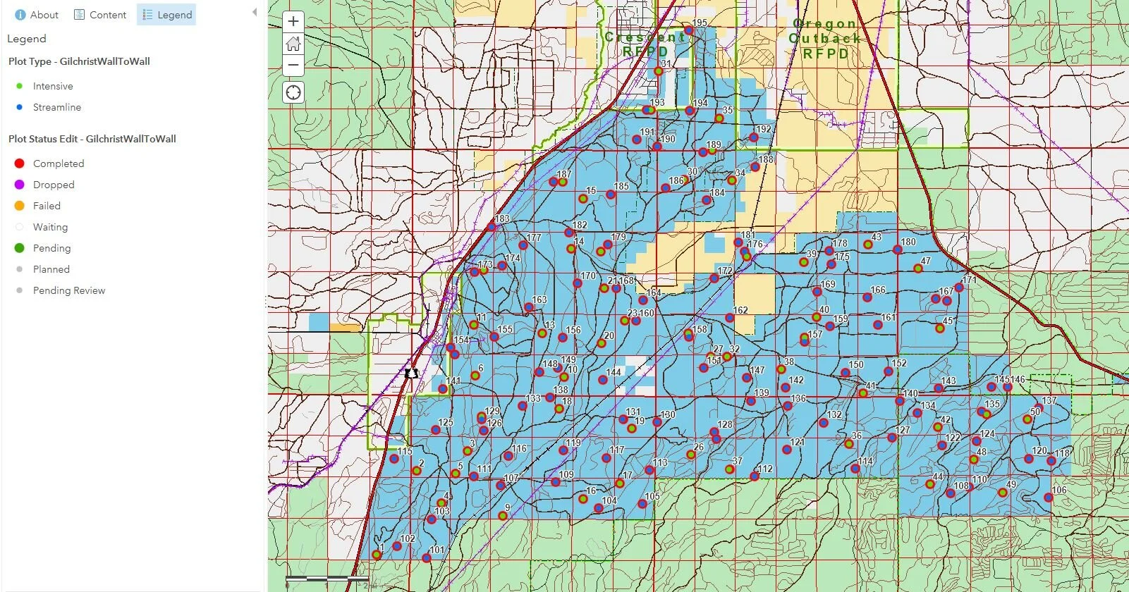
Gilchrist State Forest Inventory Project - ArcGIS Online Collector Application
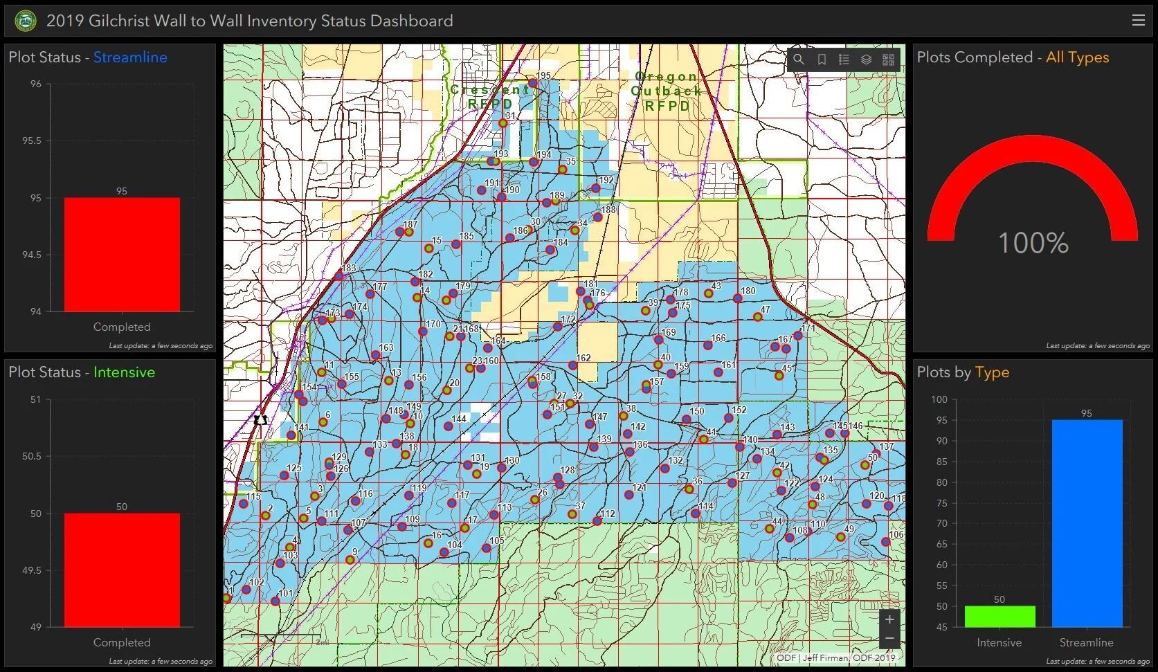
Gilchrist State Forest Inventory Project - ArcGIS Online Dashboard
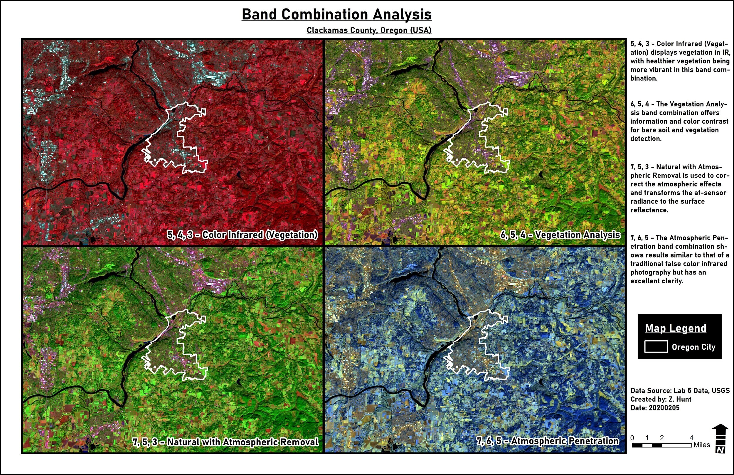
Band Combination Analysis - Clackamas County